Barangaroo’s evolution
Contact
Oct 20, 2015
Barangaroo’s evolution
Photos show how the Barangaroo precinct went from pure concrete to a green foreshore park with more than 75,000 plants.
-
 nearmap.comBarangaroo photographed in September 2015.
 -
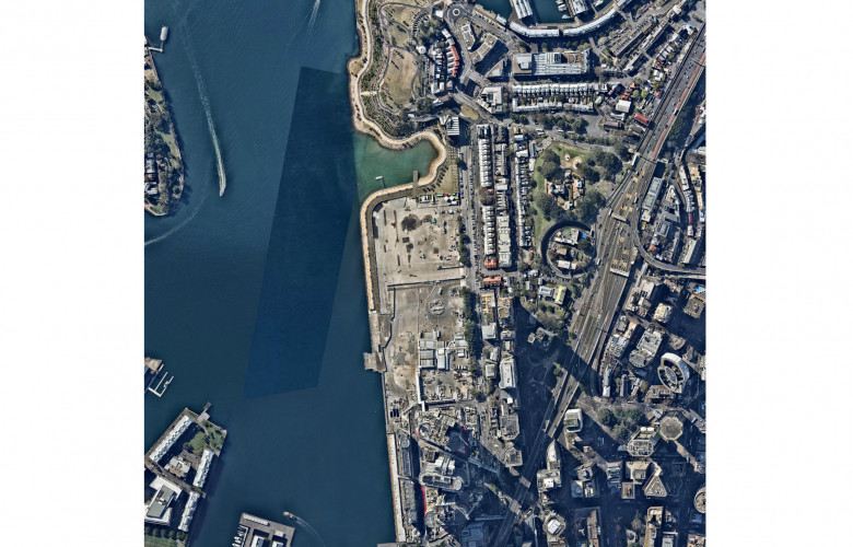
 nearmap.comBarangaroo photographed in January 2010.
 -
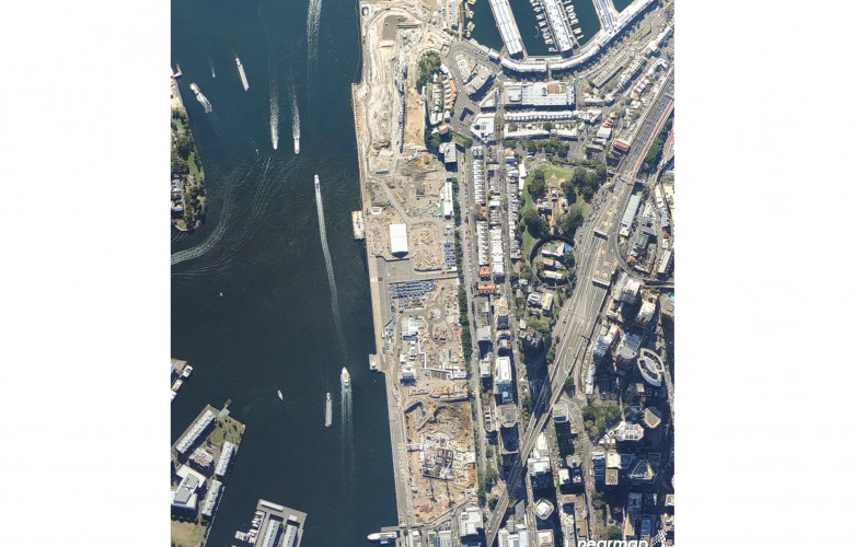
 nearmap.comBarangaroo photographed in April 2012.
 -
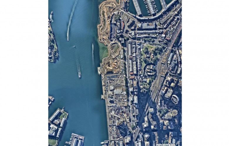
 nearmap.comBarangaroo photographed in July 2013.
 -
 nearmap.comBarangaroo photographed in June 2014.
Barangaroo, the 22 hectare western edge of Sydney Harbour, has changed dramatically in the last four years.
Closed to the public for over a century, the first part of the $6 billion redevelopment project has been completed and the Barangaroo Reserve is now open to the public. Barangaroo South and Central Barangaroo are still being constructed, and are scheduled to be completed at the end of 2019.
The transformation of the Barangaroo site is evident in these exclusive images from geospatial mapping and visual analytics company nearmap. These aerial images were taken at various stages of Barangaroo's evolution from January 2010 to September 2015. They show how the Barangaroo precinct went from pure concrete, including the Sydney Harbour Control Tower, to a green foreshore park with more than 75,000 plants.
"With rapid urban development taking place across most Australian cities, planners need to make fast and accurate decisions based on reliable up-to-date data. Everyone involved in major construction projects like Barangaroo need to consider multiple factors, as quickly as possible, while deciding the best course of action for the local community and the wider city in years to come," said nearmap’s VP and Managing Director John Biviano.
"These can include anything from housing, transport, access to education, emergency services, and recreational facilities, through to driving employment and economic development within the local community.
"Our unique technology provides urban planners with a current, clear and changing view of their developments, allowing them to analyse the many factors involved in the strategic planning of massive site developments like Barangaroo."
Contact Details:


